


Books in series
A Monterey Album
Life by the Bay
2003
African Americans in Los Angeles
2010
African Americans in Vallejo
2012

African Americans of Monterey County
2015
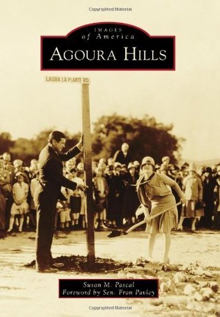
Agoura Hills
2013

Al Zampa and the Bay Area Bridges
2005

Alameda
2008
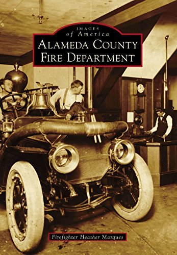
Alameda County Fire Department
2016

Alameda Naval Air Station
2010

Albany
2007

Alpine County
Bear Valley, Kirkwood, and Markleeville
2005

Alviso, San Jose
2006

Amador County
2006
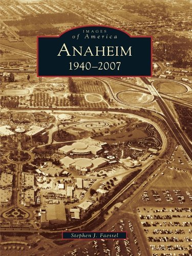
Anaheim
1940-2007
2007

Anderson Valley
2005

Angel Island
2007

Angels Camp and Copperopolis
2009

Annapolis and the Gualala River
2010

Antioch
2005

Apple Valley
2007

Arcadia
2008

Arcata
2004

Arlington
2007

Around Anza Valley
2008

Around Boron
2009

Around Murphys
2005

Arroyo Grande
2009

The Arroyo Seco
2008

Artesia
1875-1975
2000

Atwater
2005

Atwater Village
2011

Auburn
2008

Aviators in Early Hollywood
2008

Azusa
2007

Baldwin Park
2011

Banning
2005

Baseball in Orange County
2012
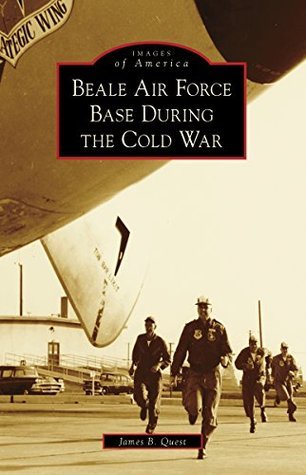
Beale Air Force Base During the Cold War
2014

Beaumont
2007

Benicia
2004

Bishop
2011

Black Artists in Oakland
2007

Black Diamond Mines Regional Preserve
2009

Blythe and the Palo Verde Valley
2005

Bolinas and Stinson Beach
2004

Bonita
2009

Brentwood
2008

Brentwood
2008

Brisbane
2009

Broadmoor Village
2010

Buellton
2006

Buena Park
2004

Building the Caldecott Tunnel
2014
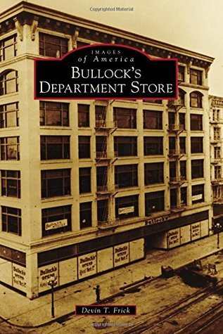
Bullock's Department Store
2015

Byron Hot Springs
2006

Cabrillo Beach Coastal Park
2009
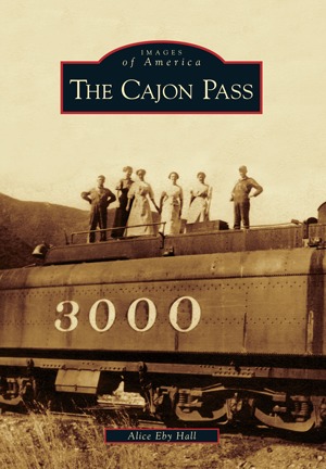
The Cajon Pass
2009

Calaveras Big Trees
2010

California Cavalry
2014

California Highway Patrol
2008

California Lighthouse Life in the 1920s and 1930s
2000

California State Fair
2010

California State Park Rangers
2009
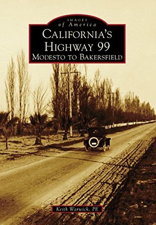
California's Highway 99
Modesto to Bakersfield
2014

Calistoga
2008

Calle Olvera de Los Angeles
2007

Cambodians in Long Beach
2008
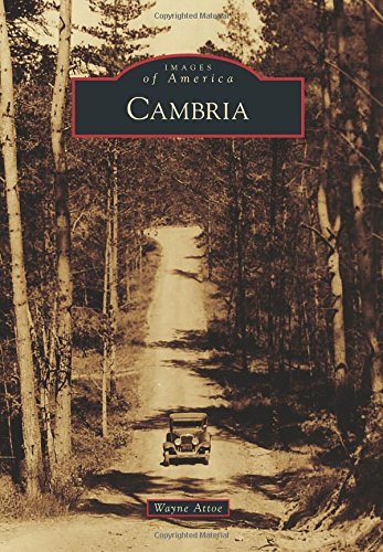
Cambria
2015

Camp Mather
2008

Camp Pendleton
2005

Camp Roberts
2005

Campbell
2004

Canyon Country
2012

Canyon Lake
2007

Capitola
2013

Cardiff-by-the-Sea
2009

Carlsbad
2009

Carmel Valley
2009

Carmel-by-the-Sea
2006

Carmel
A History in Architecture
2007

Carmichael
2004

Carpinteria
2007

Carson
2006

Catalina Island
2004

Catalina by Sea
A Transportation History
2006

Cemeteries of San Diego
2007

Cemeteries of San Diego County
2008

Cemeteries of Santa Clara
2005

Cemeteries of the Eastern Sierra
2007

Centerville, Fremont
2011

Central Americans in Los Angeles
2010

Ceres
2010

Cherry Valley
2008

Chico
2005

Chinatown in Los Angeles
2009

The Chinese Community of Stockton
2002

Chinese in Hollywood
2013

Chinese in Mendocino County
2009

Chinese in San Jose and the Santa Clara Valley
2007

Chino
2011

Chula Vista
2008

Citrus Heights
2011

Clayton
2006

Cleveland National Forest
2008

Cloverdale
2008

Clovis
2011
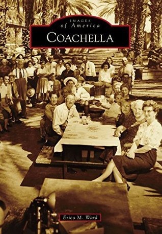
Coachella
2015

Colma
2007

Colton
2004

Columbia
2005

Community Hospital of San Bernardino
2009

Concord
2009

Conejo Valley
2010

Consolidated Aircraft Corporation
2008

Corona
2005

Coronado
2011
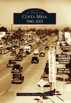
Costa Mesa
1940-2003
2016

Cotati
2004

Covina Valley Citrus Industry
2011

Crescent City and del Norte County
2006

Crestline
2005

Crockett
2004

Daly City
2003

Dana Point
2007

Davis
1910s-1940s
2000

Death Valley
2008

Del Mar Fairgrounds
2008

Delano Area
1930-2000
2000

Delano Area
1776-1930
1999
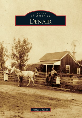
Denair
2015

Desert Hot Springs
2014

Dixon
2005

Donner Summit
2011

Downey
2010

Downtown Pasadena's Early Architecture
2006

Downtown Stockton
2004

Duarte
2009

Dublin
2007

Dunsmuir
2010

Durham
2008

Eagle Rock
2009

Eagle Rock
1911-2011
2011

Early Amusement Parks of Orange County
2008

Early Anaheim
2006
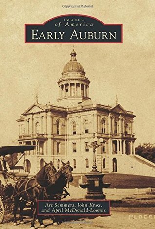
Early Auburn
2015

Early Costa Mesa
2009

Early Cupertino
2006

Early Hayward
2004

Early Livermore
2006

Early Los Altos and Los Altos Hills
2010

Early Mendocino Coast
2008

Early Mill Valley
2005

Early National City
2008

Early Pasadena
2008

Early Placentia
2007

Early Pomona
2007

Early San Rafael
2008

Early Santa Monica
2006

East Sacramento
2004

Echo Summit
2014

El Cerrito
2005

El Monte
2006
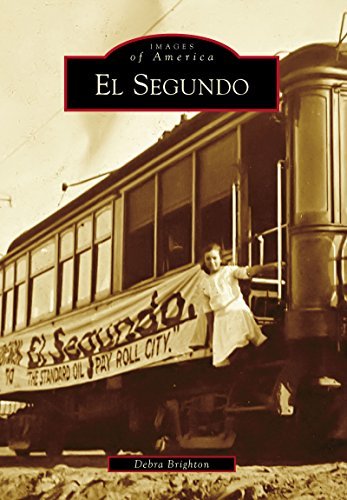
El Segundo
2016

El Sobrante
2012

Elk Grove
2007

Emeryville
2005
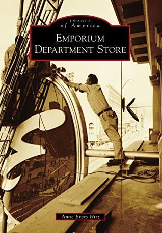
Emporium Department Store
2014

Encino
2009

Escalon
2008

Escondido Grape Day Festivals
2010

Eureka and Humboldt County
2001

Eureka and Sequoia Park
2008

Fairfax
2006

Fairfield
2005

Fallbrook
2007

Farming in Torrance and the South Bay
2008

Ferndale
2004

Filipinos in Carson and the South Bay
2009

Filipinos in Hollywood
2008

Filipinos in Los Angeles
2007

Filipinos in San Diego
2010

Filipinos in San Francisco
2011

Filipinos in Stockton
2008

Filipinos in Vallejo
2005
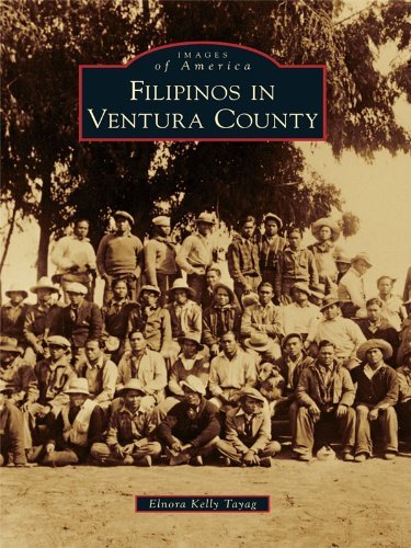
Filipinos in Ventura County
2011

Filipinos in the East Bay
2008
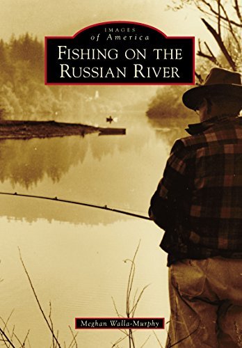
Fishing on the Russian River
2014

Flintridge
2008

Folsom Prison
2008

Folsom
1999

Fontana
2005

Forestville
2008
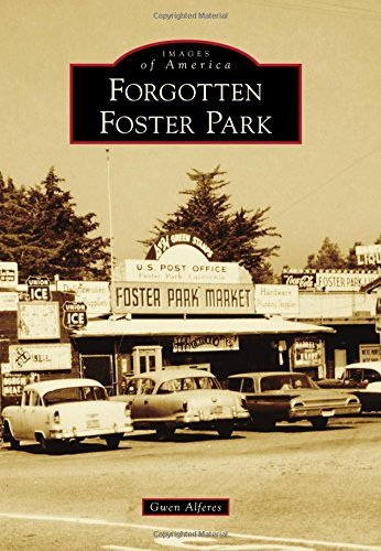
Forgotten Foster Park
2015

Fort Bragg
2014

Fort MacArthur
2006

Fort Ord
2004

Fort Ross and the Sonoma Coast
2004

Fortuna and the Eel River Valley
2011

Foster City
2005

Fountain Valley
2007
Authors


Award-winning author J.R. Sanders is a native Midwesterner and longtime denizen of the L.A. suburbs. His nonfiction articles appear in such periodicals as Law & Order and Wild West magazines. His books include Some Gave All, which gives true accounts of forgotten Old West lawmen killed in the line of duty. J.R.’s first Nate Ross novel, Stardust Trail - a detective story set among the B-Western film productions of 1930s Hollywood - was a 2021 Spur Award Finalist (Best Western Historical Novel) and Silver Falchion Finalist (Best Investigator). His second Nate Ross novel, Dead-Bang Fall, won the 2023 Shamus Award (Best Original PI Paperback).
Librarian Note: There is more than one author in the Goodreads database with this name. Jim Brown spent decades on the inside of the prison as a correctional officer and presents here historic images from the Folsom Prison museum to illustrate the incredible story of this place of stone, iron, and humanity—redeemed and incorrigible. In these pages, Brown draws upon his experience and knowledge to tell the stories of the prison’s construction, early years, officers, inmates, events such as the famed prison concerts, and distinctive stories of Folsom Prison’s unique character
Author Brian Tom was born and raised in Marysville. He is the founder of the Asian American Studies Program at the University of California, Davis-one of the first (June 1969) AAS programs in the country. He wrote the AAS proposal, taught three of the first five classes, and hired the first tenure-track faculty. He practiced law in San Francisco for over 25 years. He is the founder and director of the Chinese American Museum of Northern California. Lawrence Tom was born in Marysville's Chinatown. He was the comptroller for the California State Department of Transportation and is the tour director for the Chinese American Museum of Northern California "