

Books in series
The 1964-1965 New York World's Fair
201
Adirondack People and Places
2012
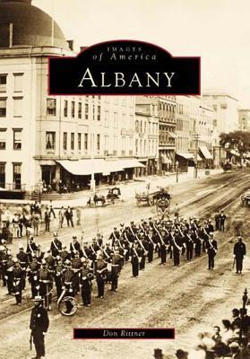
Albany
2000

Albany Revisited
2008

Albion
2005
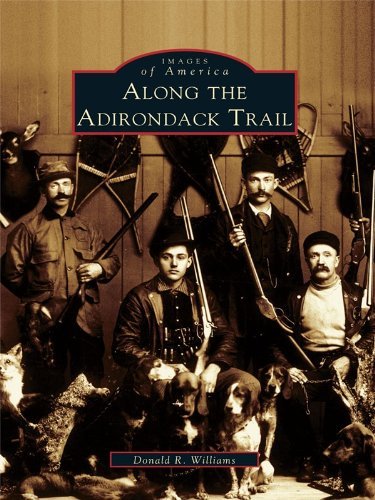
Along The Adirondack Trail
2004

Along the Battenkill
2014

Amagansett
1997

Amityville
2006

Angelica, Belmont, and Wellsville
1998

Around Auburn
1995
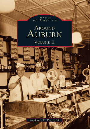
Around Auburn
Volume II
1998

Around Boonville
2009

Around Bronxville
1997

Around Burnt Hills
1998

Around Cambridge, White Creek, and Jackson
2010

Around Canandaigua
1996

Around Caroga Lake, Canada Lake, and Pine Lake
2011

Around Carthage and West Carthage
2008

Around Cayuga County
1996

Around Central Islip
1998

Around Cold Spring
2011

Around Crawford
2010

Around Dansville
2006
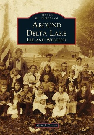
Around Delta Lake
Lee and Western
2014

Around Fishkill
1996

Around Geneseo
2004

Around Greene County and the Catskills
1997
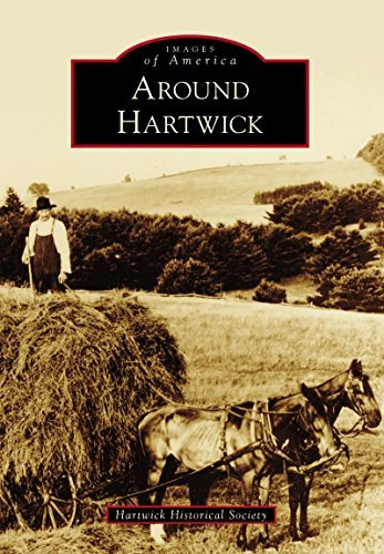
Around Hartwick
2015

Around Honeoye Lake
Richmond, Canadice, and Honeoye
2011

Around Hornell
2009
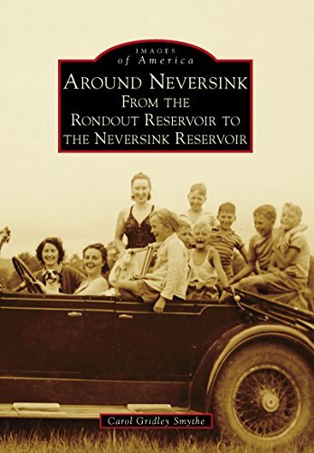
Around Neversink
From the Rondout Reservoir to the Neversink Reservoir
2014

Around Oswegatchie
2005

Around Oswego
1996

Around Perry
2010

Around Raquette Lake
2007
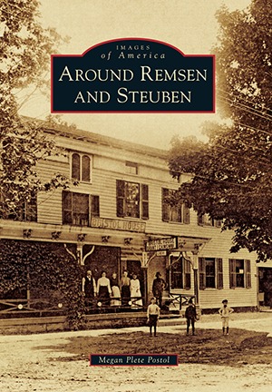
Around Remsen and Steuben
2016

Around Sylvan Beach
2008

Around Three Mile Bay
2008

Around Warrensburg
2009
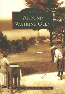
Around Watkins Glen
2006

Around Westhampton
2010

Around Windham
2011

Around the Village of Chatham
2009

Arthur Rickerby's New York City
2006

Auburn Correctional Facility
2012
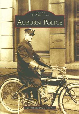
Auburn Police
2007

Aurora Revisited
2011

Bannerman Castle
2006
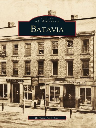
Batavia
2000

Batavia Revisited
2011

Bay Ridge
2001

Bayport Heritage
1997

Bayside
2008

Bayville
2009

Bear Mountain
2008

Bedford
2003

Bedford-Stuyvesant
2007

Beekman
2011

Bellport Revisited
2008

Bethel
2009

Bethlehem
2011
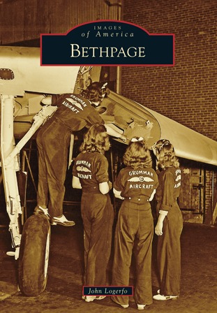
Bethpage
2015

Between the Rivers
Manhattan 1880-1920
1997

Boats and Boating on Cranberry Lake
2009

Boston
2008

Briarcliff Lodge
2004

Bridgeport
2014

Broad Channel
2008

Brooklyn in the 1920s
1998

Broome County
1850-1940
2002

Brunswick
1998
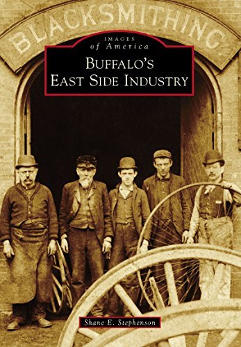
Buffalo's East Side Industry
2016

Buffalo's Pan-American Exposition
1998

Buffalo's Waterfront
1997

Canastota and Chittenango
Two Historic Canal Towns
1998

Candor
2008

Canton
2005
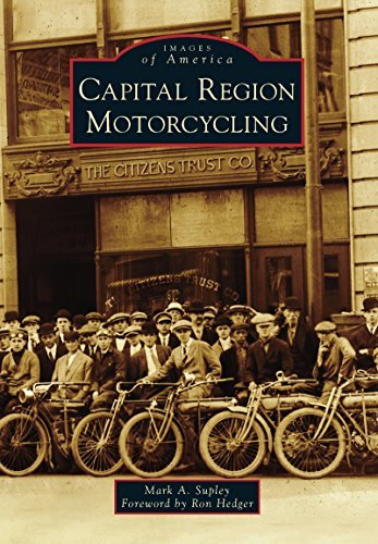
Capital Region Motorcycling
2014

Capital Region Radio
1920-2011
2013

Caribbean Americans in New York City
1895-1975
2002

Catholic New York City
2009

Catskill Village (Images of America
2009
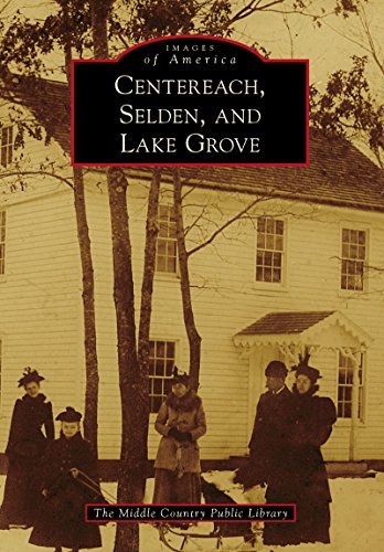
Centereach, Selden, and Lake Grove
2015

The Central Park Zoo
2002

Champion, Great Bend, and Deferiet
2012

Champlain
2006

Chautauqua Lake Region
2002

Chazy
2003

The Chemung Valley
1998

Cicero
2009
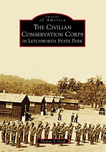
The Civilian Conservation Corps in Letchworth State Park
2015

Clarence
2012

Clayton
1998

Clifton Park
1996

Clinton County
2010

Cohoes
2001

Cohoes Revisited
2006

College Point
2004

Concord
2003

Coney Island and Astroland
2011

Constitution Island
2008

The Copacabana
2006

Copiague
2010

Corinth
2009

Corning
2003

Cornwall-on-Hudson
2009

Cortland
2010

Cortland County
1999

Cortlandt
2013

The Croton Dams and Aqueduct
2000

Croton-On-Hudson
2002

Crown Heights and Weeksville
2009

Cypress Hills Cemetery
2010
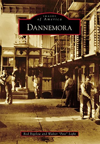
Dannemora
2015
Delaware County
2016

Dover
2008

Dunkirk
2008
Eagle's Nest
The William K. Vanderbilt II Estate
2015

East Fishkill
2006

East Hampton
2000

East Harlem
2003

East Harlem Revisited
2010
East Meadow
2016

The East River
2005

East Rockaway
2009

Eaton
2009

Eden
2011

Eleanor Roosevelt's Valkill
2002

Elmira
2013

Endicott-Johnson
2003

Erie County Fair
2014

Erwin and Painted Post
2014

Essex on Lake Champlain
2009

Evans and Angola
2009

Farmington
2011
Filipinos in New York City
2015

The Financial District's Lost Neighborhood
1900-1970
2004
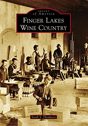
Finger Lakes Wine Country
2015

Fishkill Revisited
2012

The Five Towns
2010

Floral Park, Nassau County
2010
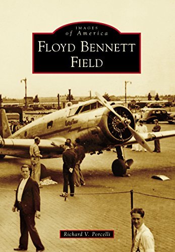
Floyd Bennett Field
2015

Fort Drum
2002

Fort Greene
2010

Fort Ontario
Guardian of the North
2000

Frankfort
2013

Franklin Square
2011

Fresh Meadows
2011

Fulton and the Oswego River
2001

Gardiner and Lake Minnewaska
2003

Geneva
2003

German Flatts
2010

German New York City
2008

Glen Cove
2008

Glen Cove Revisited
2010

Glendale
2014

Glens Falls
People and Places
2008
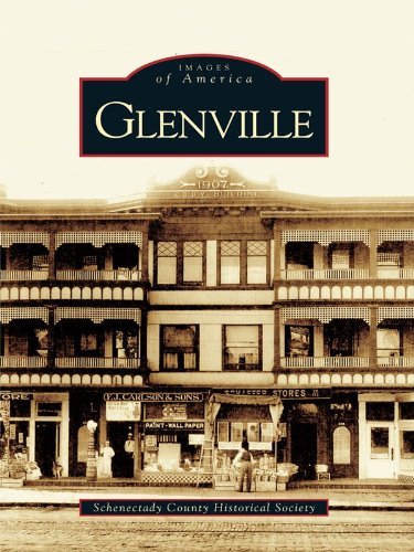
Glenville
2005

Gloversville
1998

Grafton, Berlin, and Petersburgh
2006
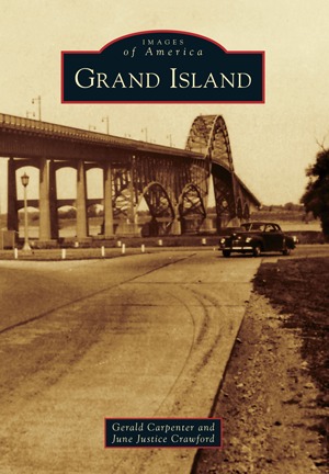
Grand Island
2015

Gravesend, Brooklyn
Coney Island And Sheepshead Bay
1996
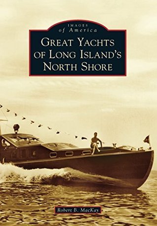
Great Yachts of Long Island's North Shore
2014

Greater Baldwinsville
2010

Greenlawn
A Long Island Hamlet
2000

Greenwich Village
2011

Griffiss Air Force Base
2008

Groton
2009

Guilderland
1999

Hadley and Lake Luzerne
2002

Hamburg
2000

Hamburg Revisited
2010

Hamburg
1910-1970
2003

Hammondsport and Keuka Lake
1998
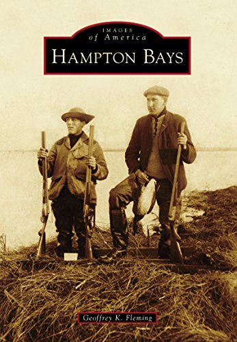
Hampton Bays
2014

Harlem Valley Pathways
Through Pawling, Dover, Amenia, North East, and Pine Plains
1998

Harriman State Park
2012

Hastings
2003

Hastings-on-Hudson
2008

Henrietta
2006

Herkimer Village
2008

Hicksville
2000

Highland and the Town of Lloyd
2009

Historic Beacon
1998

Historic Fires of New York City
2005

Historic Mexico
2009

Horseheads
2013
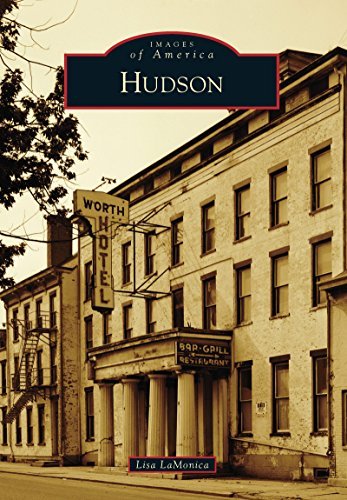
Hudson
2014

Hudson River Bridges
2007

Huletts Landing on Lake George
2008

Hurley
2007

Hyde Park on the Hudson
1996

IBM in Endicott
2005

Irish Staten Island
2009

Irondequoit
2006

Italian Staten Island
2010

Ithaca
2012

Ithaca Radio
2014

Jamaica
2011
Authors

Chris Angus comes from a literary family consisting of seven published writers He is the author of a series of historical thrillers including FLYPAPER, WINSTON CHURCHILL AND THE TREASURE OF MAPUNGUBWE HILL, THE LAST TITANIC STORY, LONDON UNDERGROUND, THE GODS OF LAKI and more. He is also the award-winning author of several works of nonfiction and of more than 400 essays, articles, book introductions, columns and reviews in a wide variety of publications, including THE NEW YORK TIMES and WORDSWORTH AMERICAN CLASSICS.


Thomas Jonathan "Stonewall" Jackson was one of the most prominent Confederate generals during the American Civil War. After attending the United States Military Academy at West Point, New York, Jackson served in the Mexican-American War from 1846 to 1848. Jackson took a teaching position at the Virginia Military Institute (VMI), in Lexington, Virginia. He became Professor of Natural and Experimental Philosophy and Instructor of Artillery. Achieved his nickname during the first battle of Manassas (Bull Run) July 21, 1861. Thereafter achieved distinction in the Peninsula Campaign, Second Bull Run and Fredericksburg before being wounded at Chancellorsville and dying of pneumonia 8 days later. Librarian Note: There is more than one author in the Goodreads database with this name. This profile may contain books from multiple authors of this name.

Richard Panchyk is the author or editor of 14 books on a diverse range of topics, including children's nonfiction (science, history, art, politics/government) and adult nonfiction (history and folklore). His works have been translated into four languages. Among his books are the award-winning and bestselling World War II for Kids, which is available at bookstores and museum gift shops across the nation. This book is considered as one of the top books ever published for teaching kids ages 9 and up about the war, and is used in schools and by homeschoolers from New York to Alaska. It features a foreword from the 2008 Republican presidential nominee, John McCain. He is also the author of the lavishly illustrated Galileo for Kids, featuring a foreword by the astronaut Buzz Aldrin. To order autographed copies of any of his books, or for more information, you may contact the author at panchyk@yahoo.com. Richard Panchyk's latest books are German New York City, published as part of the famous Images of America series by Arcadia and 101 Glimpses of Long Island's North Shore, published by The History Press. German New York City is the first-ever major book to cover the story German population in one of the world's biggest cities. It features nearly 200 historic photographs. 101 Glimpses is a pocket-sized book offering a snapshot of different beautiful locales along the historic North Shore, and features a foreword by Thomas Suozzi. Coming in 2009 - The Keys to American History, featuring more than 60 of America's most important documents and speeches.

