


Books in series
African Americans in Amarillo
2009
African Americans in El Paso
2014
African Americans in Nacogdoches County
2014
African Americans of Galveston
2013

African Americans of Houston
2013

Alpine
2011
Anderson County
2010

Andrews
2011

Aquarena Springs
2009

Argyle
2011

Arlington
2011

Around Aledo
2010

Around Columbus
2012

Around Dripping Springs
2011

Around Farmersville
2011

Around La Porte
2011

Around San Antonio
1999

Around Sanger
2011

Around Timpson
2011

Austin's Montopolis Neighborhood
2014

Bandera County
2010

Big Bend National Park and Vicinity
2009
Big Spring Revisited
2010

Big Spring and Howard County
2002

Boerne
2010
The Bolivar Peninsula
2015
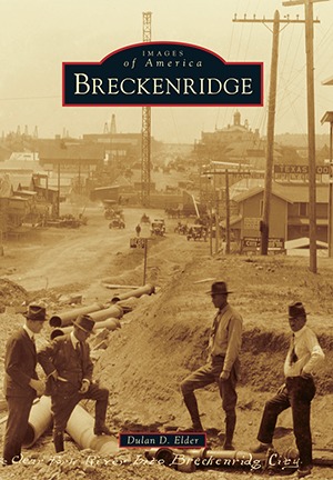
Breckenridge
2016
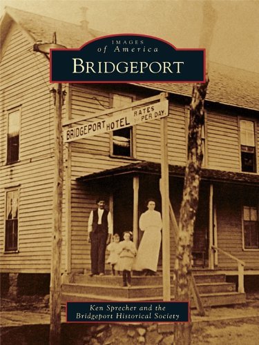
Bridgeport
2010

Bryan
2011

Burnet
2009
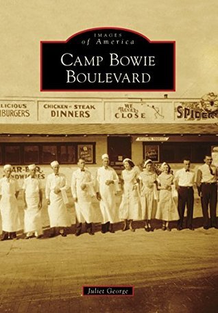
Camp Bowie Boulevard
2013

Carrollton
2008

Carthage
2009

Charro Days in Brownsville
2009

Cherokee County
2005

Clarksville and Red River County
2010

Cleburne
2009

College Station
2011
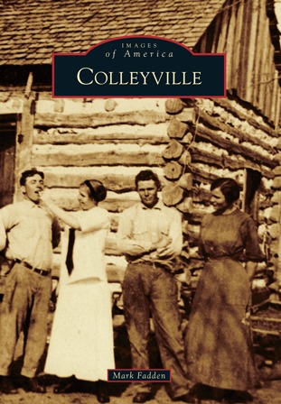
Colleyville
2015
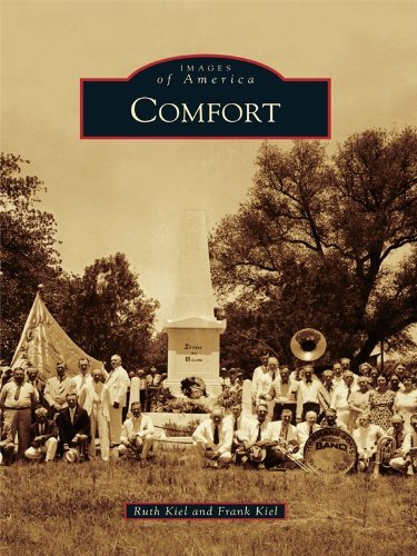
Comfort
2011

Corpus Christi
2009

Corsicana
2010

Dalhart
2011

The Dallas Music Scene
1920s-1960s
2014

Dallas's Little Mexico
2011

Dealey Plaza
2013

Delta County
2011

Denison
2011

Denton
2009

Donna
2002

Dumas
2009

Early Abilene
2010

Early San Angelo
2011

Early Settlers of the Panhandle Plains
2013

East Texas in World War II
2010

Edinburg
2011

El Camino Real de Los Tejas
2014

El Paso's Manhattan Heights
2011

El Paso, 1850-1950
2009

Elgin
2012

Ennis
2009

Foley's
2011

Fort Clark and Brackettville
Land of Heroes
2002

Fort Hood in World War II
2015

Fort Worth Parks
2010

Fort Worth Stockyards
2009

Fort Worth's Arlington Heights
2010

Fort Worth's Fairmount District
2010

Fort Worth's Historic Hotels
2013

Fort Worth's Quality Hill
2014

Gainesville and Cooke County
2000

Galveston's the Elissa
The Tall Ship of Texas
2009
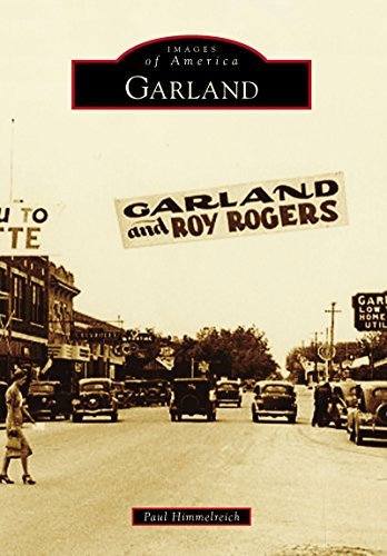
Garland
2014

Garza County
2010

Georgetown
2010

Gilmer
2009

Glen Rose Texas
2002

Goliad
2009

Grapevine
2010

Haskell County
2010

Helotes
2012

Hemphill County
2009

Hidalgo County
2000

Hillsboro
2013

Historic Dallas Hotels
2010

Historic Dallas Parks
2010
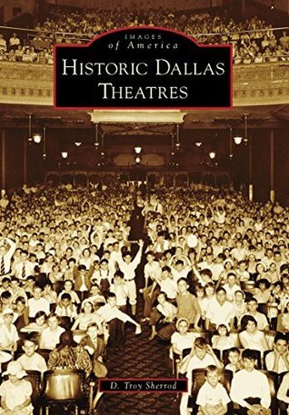
Historic Dallas Theatres
2014
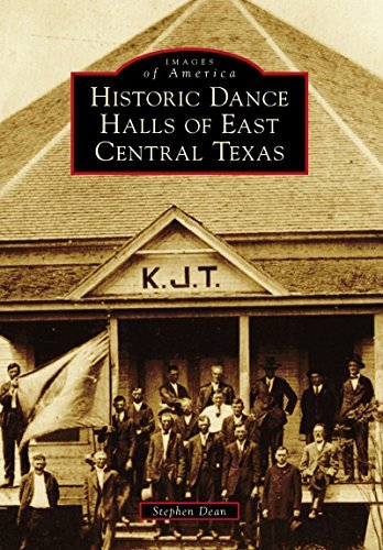
Historic Dance Halls of East Central Texas
2014

Historic Downtown Plano
2010
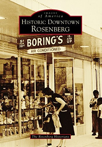
Historic Downtown Rosenberg
2015

Historic Eagle Lake
2012
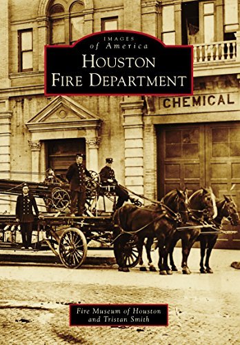
Houston Fire Department
2015

Houston's Courtlandt Place
2009

Houston's River Oaks
2013

Houston's Sporting Life
1900-1950
2011

Huntsville
2009

Huntsville Penitentiary
2013

Hutto
2009
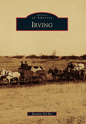
Irving
2016
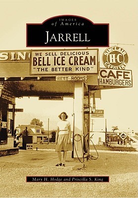
Jarrell
2009

Johnson County
2013
Katy
2015

Keller
2011

Kemah
2012

Kermit
2011

Killeen
2013

Kingsville
2011

Krum
2011

La Grange
2008

La Salle County
2010

Lake Jackson
2011

Lake Worth
2010

Lampasas County
2009

Lancaster
2009

Lee County
1999

Lost Galveston
2010
Luling
2012

Lyndon B. Johnson National Historical Park
2011

Marble Falls
2013

Marfa
2009
Mason CountyMatagorda County
2010

Matagorda County
2008

McKinney
2010
Mesquite
2015

Midland
2010

Midlothian
2008

Mineral Wells
2011

Mission
2009

Mount Pleasant
2014

Nacogdoches
2009

Nacogdoches in World War II
2011

Nocona
2011

The North Shore of Lake Travis
2010

North Texas State Fair and Rodeo
2016

Oak Cliff
2009

Pampa
2010

Pharr
2014

Pilot Point
2009

Plano
An Historic Walking Tour
2000

Port Aransas
2011

The Port of Houston
2013

Post
2013

Progreso
2010

Railroads of Western Texas
San Antonio to El Paso
2000

Rains County
2011

Ranger
2010

Roanoke
2010

Rockwall
2009

Round Rock
2008

Route 66 in Texas
2013

Royse City
2012

Salado
2014
San Antonio Cemeteries Historic District
2014

San Antonio in the Great War
2014
San Antonio's Historic Architecture
2016

San Augustine County
2010

San Benito
2010

San Juan
2010
San Marcos
2016

Seabrook
2010

Seagoville
2011
Seguin and Guadalupe County
2010
Shackelford County
2014

Sheppard Air Force Base
2015

Sixth Street
2010

Smithville
2009

Southlake
2010

Southside Place
2014

Spring Branch
2011

Stephenville
2011

Stephenville Yellow Jacket Football
2011

Sugar Land
2010

Surfing Corpus Christi and Port Aransas
2010

Taylor
2011

Temple
2010

Texas Citrus Fiesta
2015

Texas City
2011

Texas Sesquicentennial Wagon Train
2011

Texas Shipwrecks
2016
Texon
Legacy of an Oil Town
2011

Tioga and Collinsville
2014

Tyler
2008

Val Verde County
1999

Van Alstyne
2013

Waco
2009

Waxahachie
2009

Weatherford
1999
Weatherford
Historic Walking Tours
2013

West Texas Cattle Kingdom
2013

Wharton
2010

White Rock Lake
2010

White Rock Lake Revisited
2014

Wichita Falls
2009

Williamson County
2009

Wood County
2004

Yorktown and Nordheim
2011
Authors

Carol Adams has over three decades experience with historic preservation and heritage research. She has worked with the Katy Heritage Society as president and executive director, overseeing the acquisition of historic structures and the creation of Katy Heritage Park. For her work in the field of historic preservation she received the Greater Houston Preservation Alliance Good Brick Award in 1992 and 2006, and the NSDAR: Preservation Medal of Honor in 2007. Carol actively supports the Katy community as conductor of the ALL ABOARD KATY!, public art project, as a member and board member of many organizations and was elected to Katy City Council in 2008. Carol has published over seventy articles relating to Katy history and based this book on those articles, extensive research, personal interviews, oral histories and written records. A native of Houston, Carol has lived in Katy with her husband Hill since 1992. They have two children, Anne and Robert.


Romeo Rosales, Jr. is a Hispanic author originally from the Rio Grande Valley. Romeo has blogged and written extensively for Public Libraries Magazine, the official magazine of the American Library Association. Romeo received his A.A. in History from South Texas College, his B.A. in History from the University of Texas - Rio Grande Valley and his MLS from Texas Woman's University.


